Lost in Pune’s maze-like streets, I discovered the most sophisticated navigation system ever—human intuition. What auto drivers know about finding your way that GPS can’t teach.
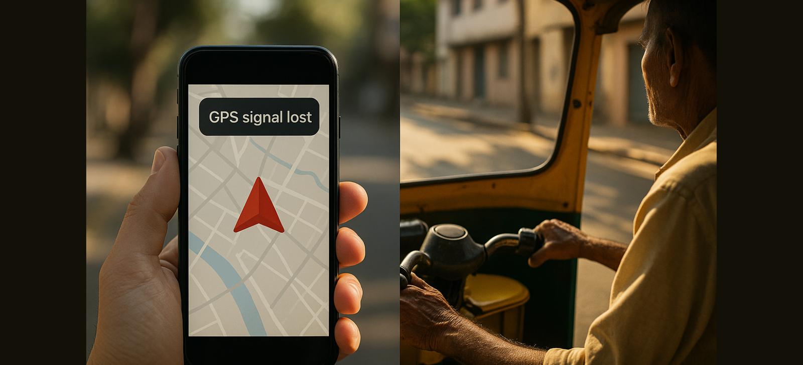
I got completely lost in Old City Pune yesterday and discovered the most sophisticated navigation system I’ve ever encountered—and it doesn’t require satellites, data plans, or battery life.
Abdul uncle has never used Google Maps, but he understands navigation with an intuition that comes from twenty-five years of threading three-wheeled vehicles through streets that change names three times in a single kilometer. When my phone died and GPS failed me in the labyrinthine alleys near Shaniwar Peth, he didn’t panic or pull out a backup device. Instead, he closed his eyes for a moment, took a deep breath, and said, “Saheb, sometimes machine is wrong. But body always knows the way.”
We reached my destination fifteen minutes faster than Google’s estimated route, using shortcuts that don’t exist on any digital map.
This morning, reflecting on how Abdul navigated purely by feel, smell, and thirty years of accumulated spatial memory, I realized something profound: in our rush to outsource navigation to algorithms, we’ve forgotten that the most sophisticated GPS system was installed in humans long before satellites existed.
The Intuitive Navigation Reality
Here’s what Abdul has mastered that no GPS can replicate:
- Sensory mapping: He navigates by the smell of particular restaurants, the sound of specific temples, the feel of road textures under his wheels
- Time-sensitive routing: He knows which routes are faster at different times based on school schedules, office hours, and local festivals
- Dynamic adaptation: When construction blocks a usual path, he improvises instantly using spatial intuition rather than waiting for map updates
- Cultural navigation: He understands that some shortcuts require permission from local communities, others depend on seasonal accessibility
Research in cognitive psychology shows that experienced navigators develop what scientists call “cognitive maps”—internal spatial representations that are often more accurate and flexible than digital alternatives. <cite>¹</cite> Abdul’s brain has spent twenty-five years building a three-dimensional, time-sensitive, culturally-aware map of Pune that no algorithm can match.
The University of the Streets
Walk through any Indian city with an experienced auto driver and you’re essentially touring a living navigation laboratory. No GPS course, no orientation training—just thousands of hours of real-time spatial problem-solving.
The rikshawala who navigates Mumbai’s maze-like slums has mastered something that urban planners spend years trying to understand: how informal settlements create their own logic of movement and access. He knows which narrow lanes can accommodate his vehicle, which ones flood during monsoon, and which ones require social navigation as much as spatial navigation.
According to research on spatial cognition, “expert navigators develop superior abilities in spatial memory, landmark recognition, and route optimization compared to individuals dependent on external navigation aids.” <cite>²</cite> But what research doesn’t capture is the emotional intelligence required for urban navigation in India.
The auto driver doesn’t just know where streets are—he knows which neighborhoods welcome outsiders, which communities require respectful approach, and which areas have informal protocols for passage. This is navigation as cultural diplomacy.
The Trust-Your-Gut School of Wayfinding
“GPS tells you shortest distance,” Abdul explained as we navigated through streets that weren’t on any map. “But shortest distance is not always best way. Sometimes you must go around to go forward.”
I watched him make navigation decisions that seemed counter-intuitive but proved correct:
Taking a longer route to avoid a traffic pattern that hadn’t happened yet Choosing narrow lanes over main roads based on “feeling” about timing Making seemingly random turns that led to perfect shortcuts Stopping to ask directions not for information, but to confirm what his intuition already knew
Dr. Gerd Gigerenzer’s research on “fast-and-frugal heuristics” demonstrates that intuitive decision-making often outperforms complex analytical approaches, especially in uncertain environments. <cite>³</cite> Abdul’s navigation style embodies this principle perfectly.
“Phone gets confused in narrow lanes,” he told me. “Too many buildings, signal weak. But I have twenty-five years of going wrong before going right. Mistakes make better map than machine.”
Lessons in Spatial Intelligence from the Road
During my unexpected navigation lesson with Abdul, I learned principles that apply far beyond finding your way through city streets:
Trust accumulated experience over immediate information: Abdul’s twenty-five years of wrong turns and successful shortcuts created a database that no real-time traffic app can match.
Read environmental cues others miss: While I was looking for street signs, Abdul was noticing wind direction (indicates weather changes that affect traffic), cooking smells (time of day indicators), and crowd patterns (festival or event awareness).
Understand that shortest isn’t always fastest: The most direct route often involves the most obstacles. Sometimes you need to go around to go forward—a principle that applies to life goals as much as street navigation.
Develop multiple backup systems: When GPS failed, Abdul didn’t panic because he’d never relied solely on external systems. His navigation was distributed across visual landmarks, spatial memory, cultural knowledge, and intuitive sensing.
The Innovation of Ancient Systems
What struck me most about Abdul’s navigation was how he’d integrated modern tools without becoming dependent on them. He uses landmarks that Google Maps can’t recognize: the particular quality of light at certain intersections, the rhythm of honking patterns that indicate traffic flow, the subtle elevation changes that suggest which routes will flood during monsoon.
MIT researcher Dr. Carlo Ratti’s work on “senseable cities” explores how urban environments can be understood through multiple data streams beyond digital mapping. <cite>⁴</cite> Abdul has been practicing senseable navigation for decades, using his body as a sensor array that detects patterns invisible to satellites.
“Machine sees road,” he explained. “But road is not just road. Road is people, time, weather, festival, construction, politics. Machine cannot see complete picture.”
The Trust Economy of Getting Lost
Here’s what surprised me most about navigating with Abdul: getting lost became part of the journey, not a failure to avoid.
When we took what turned out to be a dead-end lane, Abdul didn’t immediately reverse course. Instead, he asked a local vendor for directions—not because he needed the information, but because the interaction itself provided spatial and social context.
“Getting lost is also navigation,” he said. “Sometimes wrong way teaches you right way better than right way teaches you right way.”
This philosophy transforms the relationship with uncertainty. Instead of fearing wrong turns, you use them as information gathering opportunities. Instead of demanding perfect routes, you develop comfort with improvisation.
Psychologist Dr. Sherry Turkle’s research on digital dependency shows that over-reliance on GPS systems atrophies our spatial reasoning abilities and reduces our tolerance for uncertainty. <cite>⁵</cite> Abdul’s approach builds both skills simultaneously.
Real-Time Environmental Reading
Abdul adjusts his navigation based on sensory input that no digital system tracks:
Morning navigation: Follows cooking smoke patterns to identify residential shortcuts opening up Afternoon routing: Uses shadow angles to determine which narrow lanes will be too hot Evening wayfinding: Navigates by sound—temple bells, market activity, school dismissal patterns Monsoon adaptation: Chooses routes based on drainage patterns learned over decades
This isn’t just navigation—it’s environmental literacy applied to urban mobility.
The Network Effect of Local Knowledge
Street navigation operates on information networks that make social media look primitive.
Auto drivers share real-time intelligence about road conditions, police checkpoints, festival processions, and construction updates through informal communication systems that update faster than any traffic app.
When Abdul needed to confirm a route change, he didn’t check his phone—he honked a specific pattern at another auto driver going the opposite direction. A brief exchange of hand signals provided traffic condition updates for the next five kilometers.
Sociologist James C. Scott’s research on “local knowledge systems” reveals sophisticated information sharing networks that operate parallel to formal communication channels. <cite>⁶</cite> These networks are more responsive, culturally embedded, and contextually intelligent than algorithmic alternatives.
Navigation as Meditation Practice
What I learned from Abdul transforms navigation from a means to an end into a mindfulness practice.
Instead of staring at a screen while being transported passively, intuitive navigation requires constant awareness: noticing environmental changes, reading social cues, feeling the rhythm of urban movement.
“When you pay attention to everything,” Abdul said, “everything teaches you something. Road is teacher, traffic is teacher, even mistake is teacher.”
This approach to navigation becomes a form of urban meditation—staying present with immediate sensory experience while maintaining awareness of larger spatial relationships.
The Philosophy of Finding Your Way
After three hours of navigation without GPS, I realized Abdul had taught me something deeper than route-finding. He’d demonstrated a philosophy of trust—trusting accumulated experience, trusting environmental feedback, trusting the process of exploration even when destination remains uncertain.
“In life also,” he reflected as we reached my destination, “people use GPS too much. Always looking at phone instead of looking at life. Sometimes you must trust your feeling more than your thinking.”
What Boardrooms Can Learn from Auto Stands
The navigation principles Abdul demonstrated apply to business decision-making as much as street-finding:
Develop multiple information sources: Don’t rely solely on data analytics. Cultivate intuitive sensing, environmental awareness, and cultural intelligence.
Trust accumulated experience over immediate information: Years of trial and error create decision-making patterns that real-time data can’t match.
Read environmental cues others miss: Success often comes from noticing subtle patterns that aren’t captured in formal metrics.
Understand context matters more than efficiency: The fastest route isn’t always the best route. Sometimes you need to go around obstacles rather than through them.
Build comfort with uncertainty: Perfect information is rarely available. Develop skills for navigating ambiguous situations with confidence.
Maintain human networks alongside digital systems: Algorithmic intelligence works best when combined with social intelligence and local knowledge.
The Spatial Intelligence Renaissance
Our GPS dependency has created what researchers call “spatial amnesia”—the atrophy of natural navigation abilities that humans developed over millennia. Abdul represents a different approach: using technology as enhancement rather than replacement for innate spatial intelligence.
Dr. Véronique Bohbot’s neuroscience research shows that people who rely heavily on GPS systems show reduced activity in the hippocampus, the brain region associated with spatial memory and navigation. <cite>⁷</cite> Meanwhile, people like Abdul who navigate primarily through spatial memory maintain enhanced cognitive abilities well into old age.
The Direction Forward
In an age of increasing automation and artificial intelligence, Abdul’s navigation mastery offers a compelling alternative: human intelligence enhanced by, but not dependent on, digital tools.
He uses his phone for communication, accepts digital payments, and occasionally checks traffic apps. But his core navigation system remains biological, intuitive, and accumulated through decades of experiential learning.
“Technology is good servant,” he told me as I paid for the ride, “but bad master. Best navigation is machine plus man, not machine instead of man.”
The Inner GPS
As I walked away from Abdul’s auto, I realized he’d taught me something applicable far beyond street navigation: the art of trusting internal guidance systems while remaining open to external input.
Whether you’re finding your way through city streets, career decisions, or life transitions, the same principles apply: develop multiple sensing systems, trust accumulated wisdom, read environmental cues, maintain networks of human intelligence, and remember that getting lost sometimes teaches you more than arriving efficiently.
The most sophisticated navigation system isn’t in your phone—it’s in your capacity to pay attention, trust your accumulated experience, and remain present with the journey even when the destination remains uncertain.
Your inner GPS has been calibrating for years. Sometimes the wisest thing you can do is turn off the external noise and listen to what your accumulated experience already knows.
The way forward isn’t always straight ahead. Sometimes you have to trust that the path will emerge as you walk it.
Frequently Asked Questions
Q: How accurate is intuitive navigation compared to GPS? A: Research shows that experienced navigators often outperform GPS in complex urban environments, especially when dealing with construction, cultural factors, or time-sensitive routing that digital maps can’t account for. GPS is excellent for unfamiliar territory, but local intuitive knowledge excels in home environments.
Q: Can intuitive navigation skills be developed, or are they innate? A: Spatial intelligence can definitely be developed through practice. The key is reducing GPS dependency gradually, paying more attention to environmental cues, and building spatial memory through active observation rather than passive following of directions.
Q: What’s the business application of “navigation without GPS”? A: In business, this translates to developing multiple decision-making systems: combining data analytics with intuitive pattern recognition, industry experience with real-time market sensing, and algorithmic intelligence with human network intelligence.
Ready to explore more wisdom from India’s most unexpected teachers?
Subscribe below for weekly lessons from the street university—where the most profound insights come with the most practical applications.
Navigation skills for roads, life, and everything in between.
Your next breakthrough might be one wrong turn away.
Leave a Reply